Qhapaq Ñan: The inka road linking Machupicchu to Lima
Síguenos en:Google News
 31/01/2025
Fuente: Shutterstock
To explore the impressive Qhapaq Ñan road system is to grasp a significant part of Peru's history and the true scale of its heritage today.
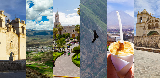
The Qhapaq Ñan, or Great Inka Trail, is an extensive network of pre-Hispanic roads that linked the vast Inka Empire. Stretching over 40,000 kilometers, including its branches, it connected territories from Colombia to Argentina and Chile.
 Source: Shutterstock
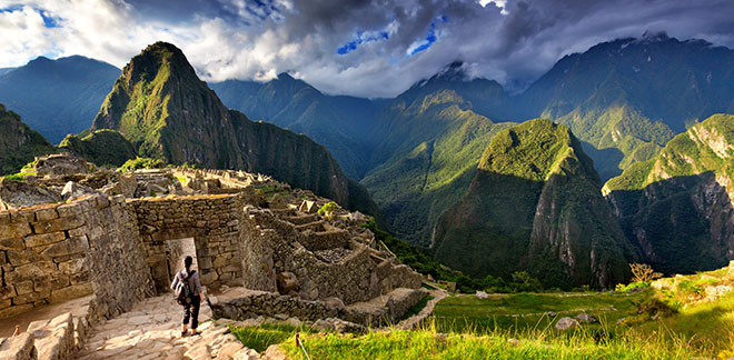
Today, the Qhapaq Ñan not only links modern communities to their ancestral past but also serves as a major tourist attraction. It draws hikers and adventurers eager to explore the ancient Inka trails, with iconic routes like the Inka Trail to Machupicchu being among the most famous.
What you should know
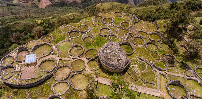
Trekking along the central section of the Qhapaq Ñan typically covers between 14.5 and 22.5 kilometers per day, depending on the route's length. The journey can be physically demanding, mainly due to the altitude. Notably, beyond Huanuco Pampa—an important administrative and religious site of the Great Inka Trail—there are no designated campsites. As a result, most hikers set up their tents near tambos or on local family farms, paying a small fee to the community for their stay.
Temperatures can drop below freezing at night, while days are typically sunny and windy. Although the Great Inka Trail is not particularly difficult to hike, the altitude and remote location make it challenging. For this reason, most visitors hire llamas—native Peruvian camelids—to carry supplies and rely on cooks to prepare meals along the journey.
The connection with Lima
Within this vast network, the section linking Machupicchu to Lima, Peru’s capital, stands as a remarkable testament to the engineering, organization, and foresight of the ancient Inkas.
In Lima, the Qhapaq Ñan began in the district of Ancon, following the Pasamayo bypass before joining the old Pan-American Highway and continuing along avenida Tupac Amaru. After passing through Lima Norte—which includes the districts of Puente Piedra, Carabayllo, Comas, and Independencia—it crossed the Rimac district via avenida Pizarro, extending through prolongacion Tacna. The route then entered Lima along what is now known as pasaje Camaroneros.
The road continued through jirones Rinconada de Santo Domingo, Conde de Superunda, and Junin, passing through what is now Italia Square before heading directly toward the Sierra region. Additionally, at the intersection with jiron Huanuco, a new branch extended southward.
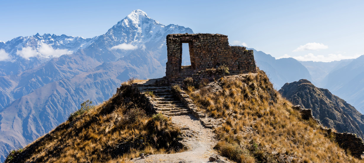
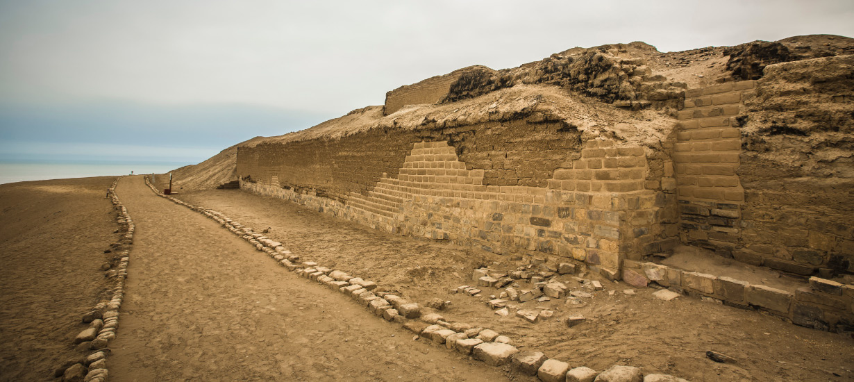
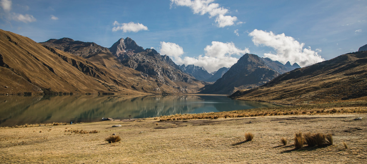
In the district of Tanta, province of Yauyos, in the Lima region, there is a section of the Qhapaq Ñan situated between the lower slopes of Portachuelo Hill’s northeastern end and Huiñac Hill, near Piticocha Lagoon.
The Portachuelo-Piticocha road is one of the best-preserved sections of the Qhapaq Ñan and forms part of the route that connected the Inka administrative center of Hatun Xauxa (Junin) with the Archaeological Sanctuary of Pachacamac (Lima). The road is surrounded by a breathtaking landscape of mountains and lagoons, all dominated by Pariacaca, the region’s Apu.
 Source: Shutterstock
Origins and meaning of the Qhapaq Ñan
The term Qhapaq Ñan comes from two Quechua words: Qhapaq, meaning 'lord' or 'principal', and Ñan, meaning 'road.' Together, these terms can be translated into Spanish as "camino del Señor" (path of the Lord).
It is important to note that the pre-Inka civilizations had already established roads and routes that the Inkas later incorporated into their own system. The Qhapaq Ñan was designed to unify the various regions of Tahuantinsuyo, facilitating the transportation of goods, military movement, and administrative communication across the vast empire.
You may be interested in
Qhapaq Ñan, el patrimonio mundial incaico que une seis países
Engineering masterpiece
The construction of the Qhapaq Ñan required an advanced understanding of geography and engineering. The tangible evidence of this expertise can be seen in the following structures left by the Inkas:
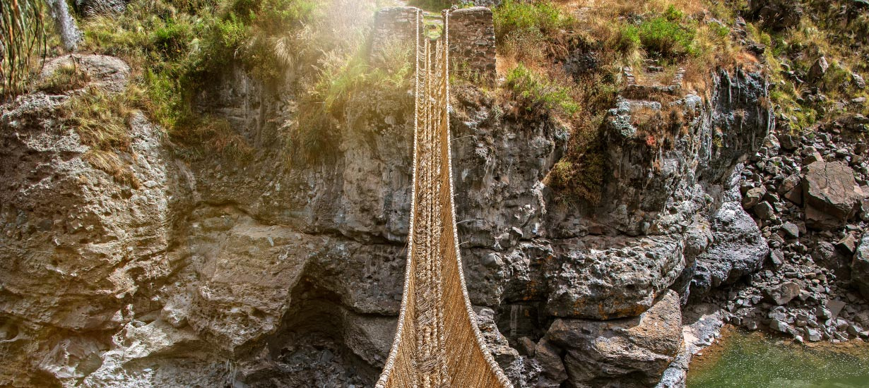
Hanging bridges: These structures allowed for the crossing of powerful rivers and steep slopes, essential in the rugged Andean geography.
Tambos: Strategically placed shelters where travelers (chaskis) could rest and store supplies along the route.
 Source: Shutterstock
For all these reasons, the Qhapaq Ñan stands as a symbol of the Inka Empire’s greatness, showcasing its mastery over geography and its ability to unite diverse cultures. Moreover, this ancient route serves as a powerful reminder that, even in the modern era, we can still learn from the engineering, organization, and vision of our ancestors.
For those eager to explore it—whether as tourists or photographers—this trail offers an unforgettable experience that blends history, nature, and adventure. It is an opportunity not to be missed.